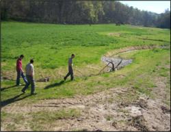
Habitat Data Collection to aid Buck Creek Watershed Restoration
| Project Start Date | |
|---|---|
| Project Leader | |
| Organization |
Restoration of native vegetation, streams, riparian zones and wetlands along Buck Creek and its tributaries is an ongoing project that needs physical habitat data specific to target species of fishes and mussels. The restoration effort is addressing Kentucky’s number one source of impairment — sedimentation and siltation. The overall goal is to tailor existing stream restoration efforts to benefit over 11 species of fish and mussels including sport fish, federally listed endangered species, and sensitive species in Buck Creek.
Partner(s): The Nature Conservancy Natural Resources Conservation Service US Fish & Wildlife Service Kentucky Department of Fish & Wildlife Resources
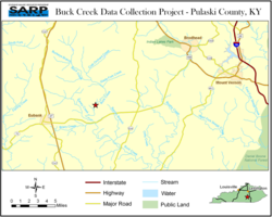
- Buck Creek Data Collection Project -
- Pulaski County, KY
Description of Site:
- A 1.3 mile section of Buck Creek, its tributaries, the adjacent floodplain and adjacent wetlands.
- Restoration will be concentrated on an approximately 260-acre tract of land.
Problem:
-
Reliable microhabitat data is needed. Many stream restoration projects rely on composite data or averages which may fail to address specific microhabitat needs of species groups.
Strategy:
- Data are being gathered from Cumberlandian streams
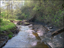
- Headwaters of Buck Creek in degraded
- condition.
- Restoration work on Buck Creek proper uses the design information gathered from this data collection project.
About 50% of the data collection has been completed. Restoration of Buck Creek and its tributaries is ongoing.
Contact Info
Related Resources & Documents
On-going
Associated Locations
| Town | zip code | county | state | congressional dist |
|---|
Barriers
| Name of barrier | Latitude | Longitude | FONS ID | FIS Project ID | FWS Acc. # |
|---|
Document Actions

